DIRECTIONS. Belleplain State Forest and Delaware Bayshore, Cumberland County, New Jersey
From Millville take Rt 55 South until it ends and becomes Rt 47. When it splits, take Rt 347. ✪Wawa available here, on right. This is a good place for a trip meeting for a large group. When you leave the Wawa, cross 47 at light, and turn right on 347.
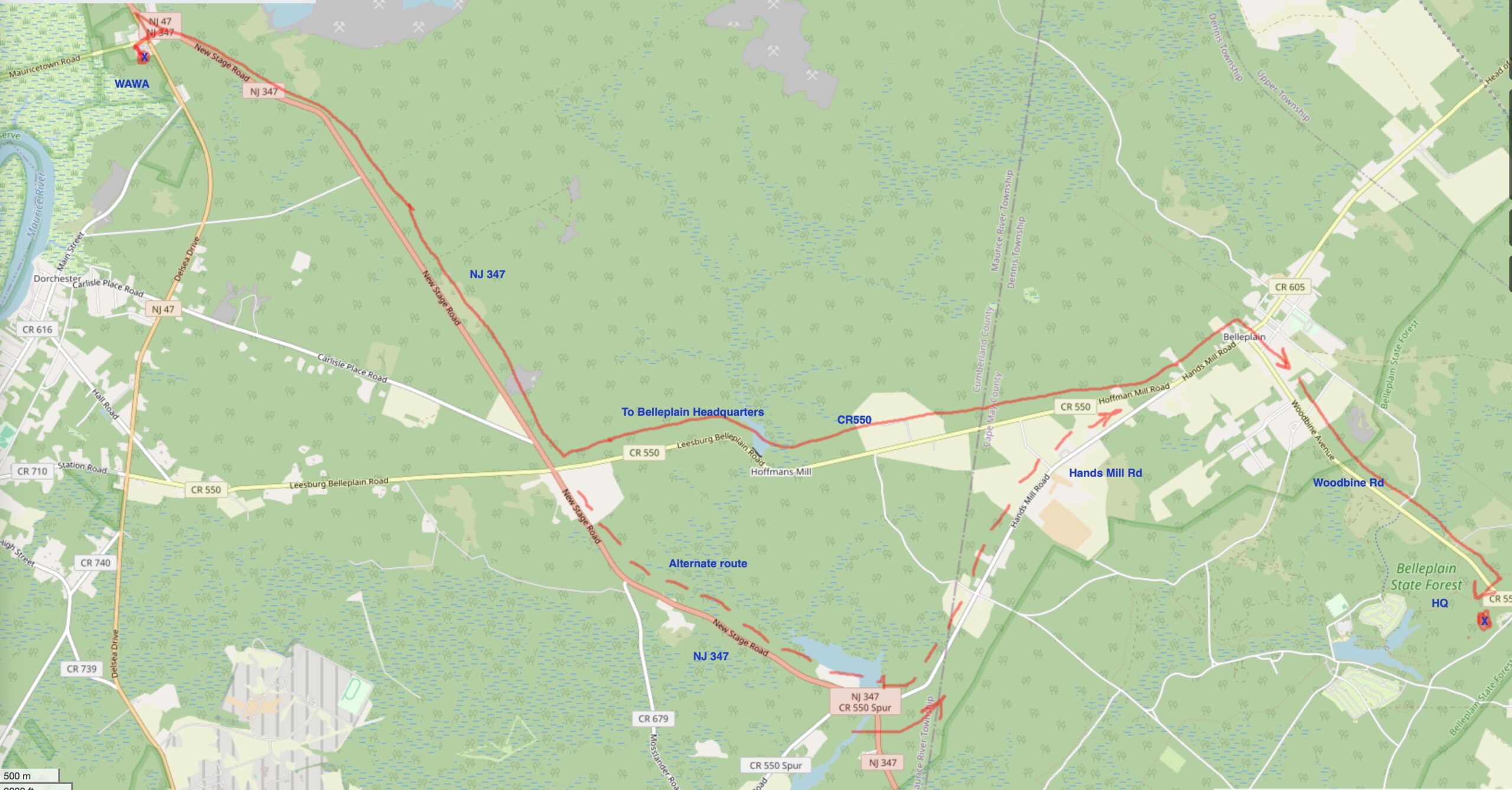
Continue on Rt 347 to County RD 550 and turn LEFT. Continue on CR 550 and watch for RIGHT turn on Woodbine Rd. After a few miles look for park Headquarters, a RIGHT turn on Henkensifkin Rd. (If you miss CR 550, look for Alternate Route on Hands Mill Rd just past the pond on left. Rejoin CR 550 and proceed as above to Headquarters.)
GPS: 39.248540, -74.842798 1 Henkinsifkin Road, Woodbine, NJ 08270
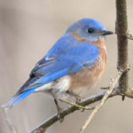
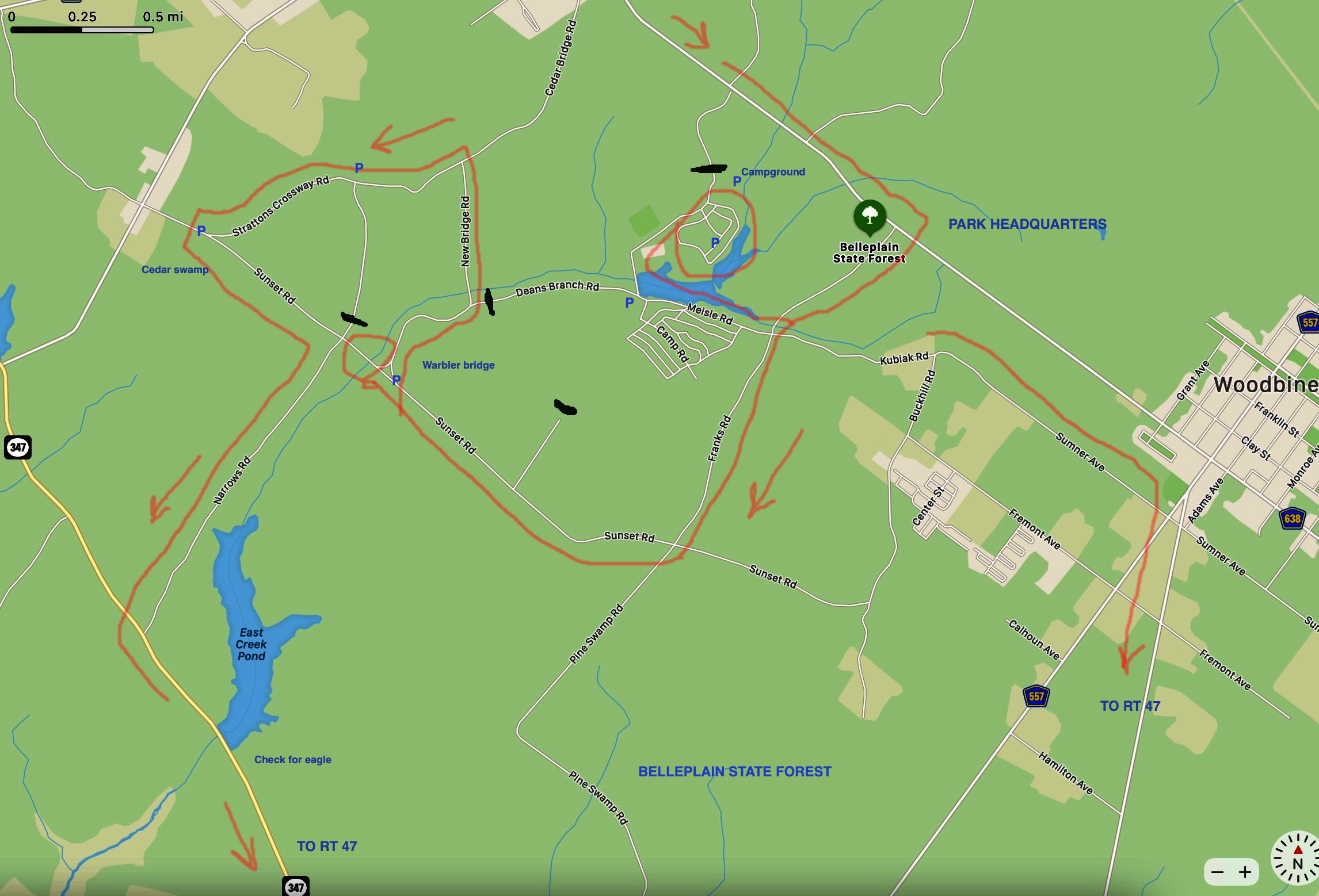
- Birding in Belleplain State park: Park at the Park HQ parking lot. Maps and restrooms available. Bird the parking lot for warblers, vireos, hummingbird feeder, bluebirds.
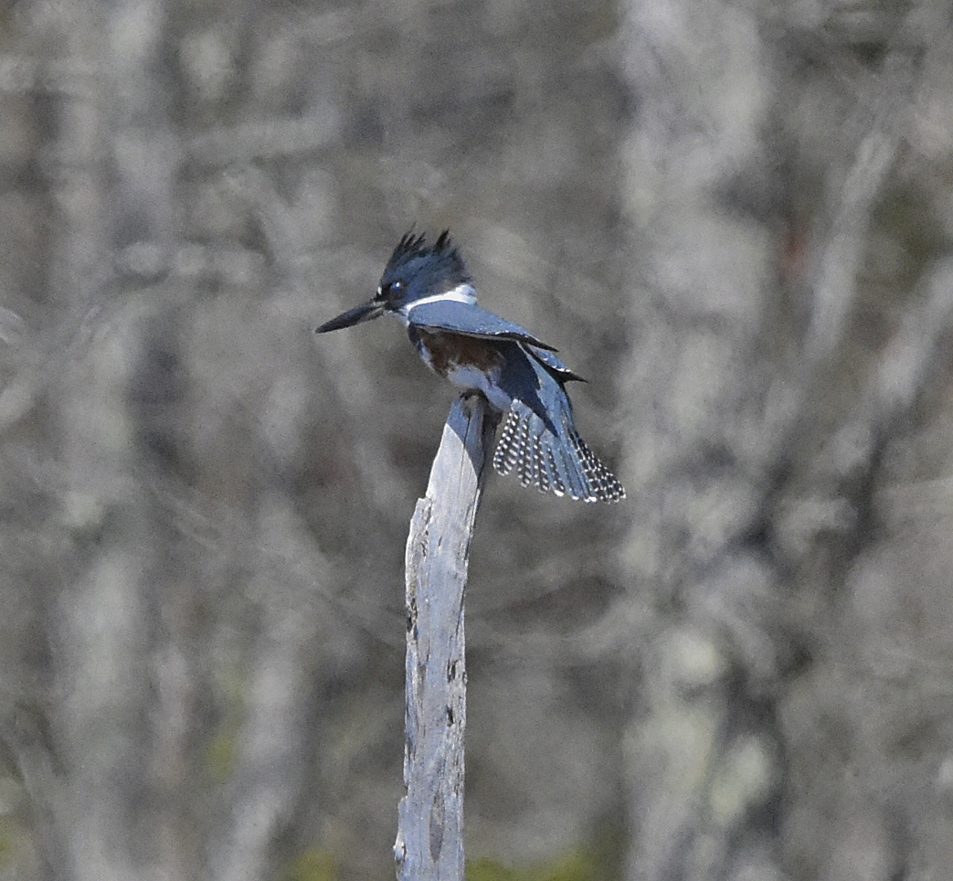
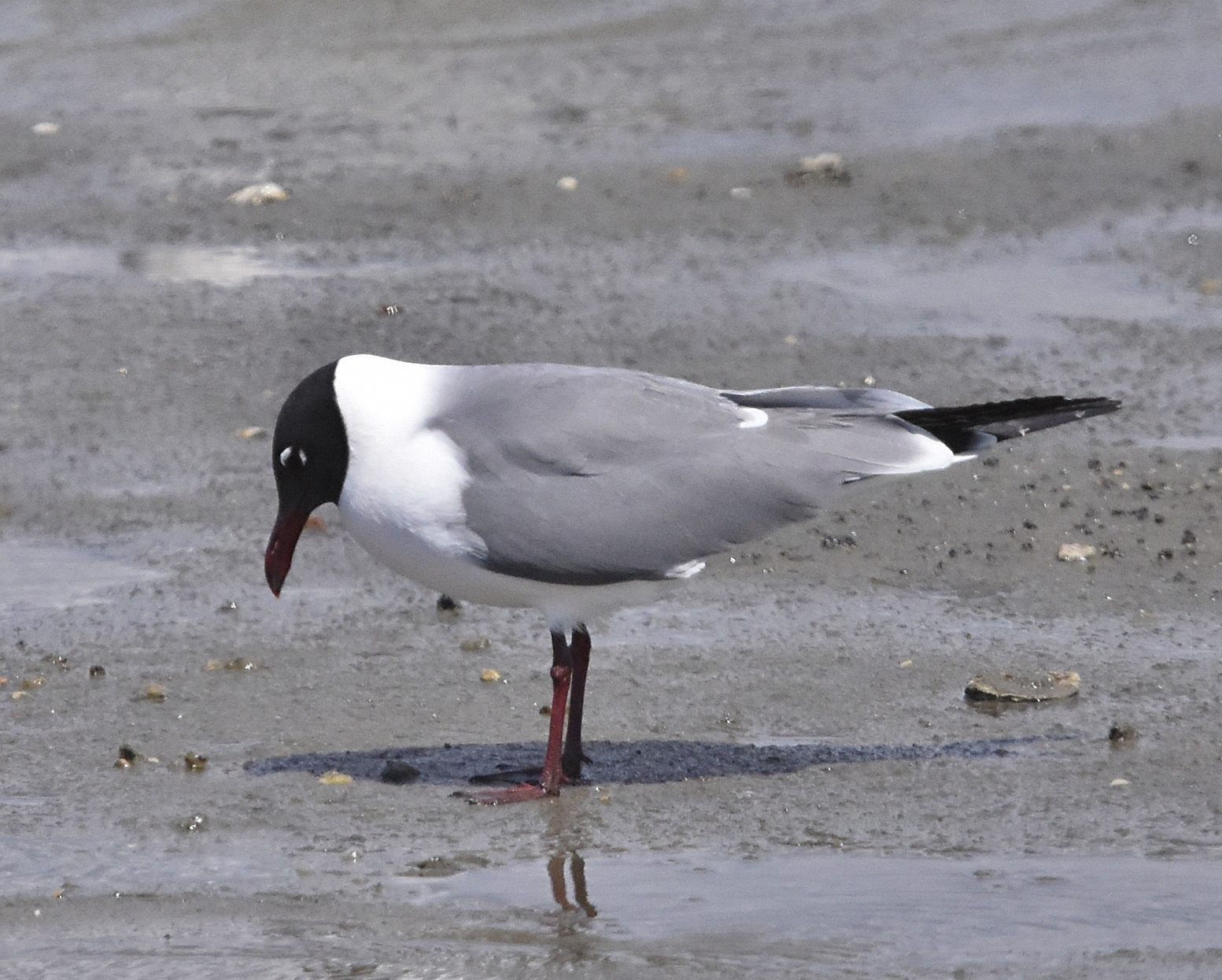
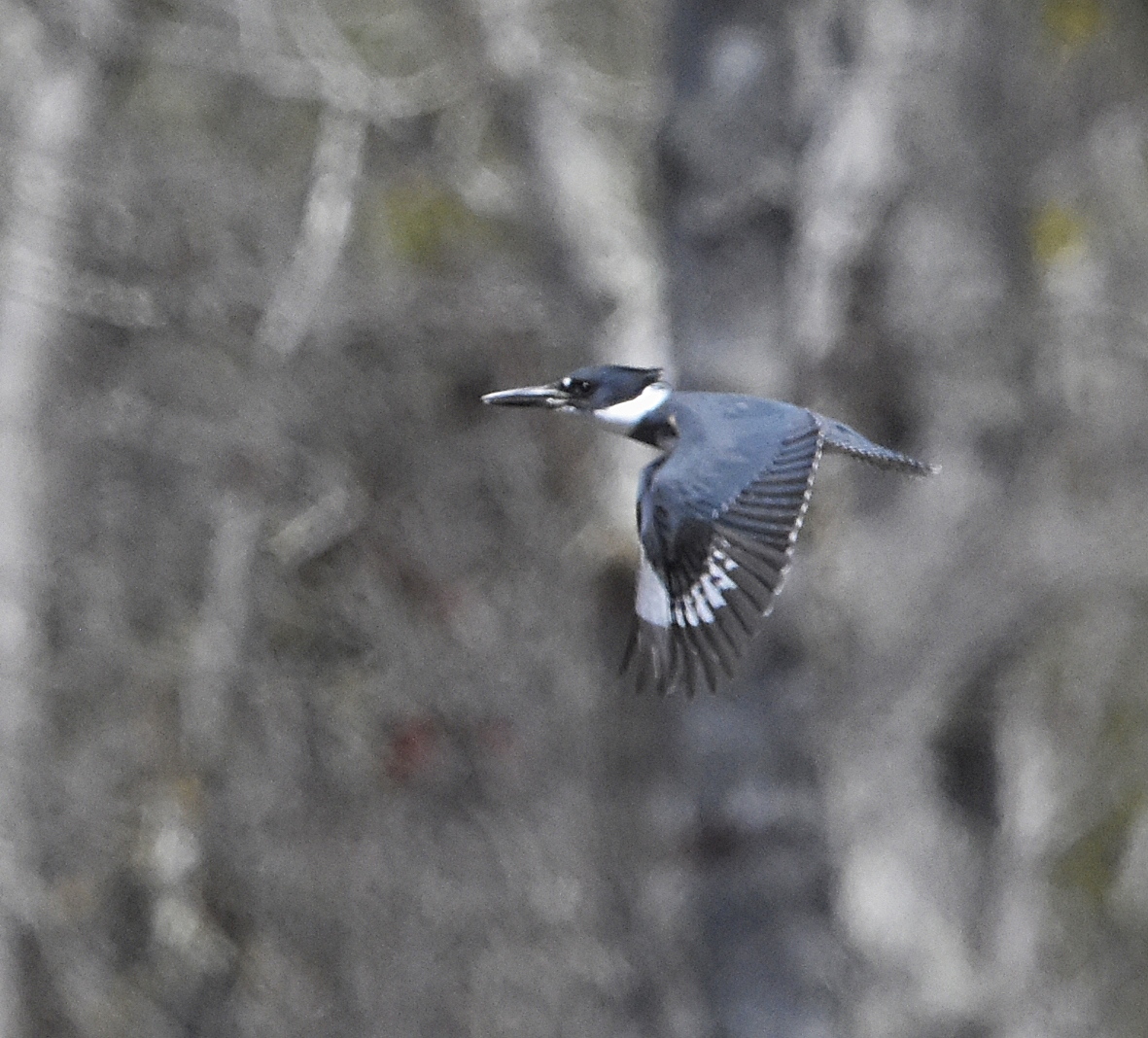
Take Franks Rd RIGHT from HQ and then first RIGHT on Meisle Rd to Campground. Check the lake and picnic area; Yellow-throated Warbler, migrants, kingfisher, spotted sandpiper. Return to Franks Rd. then turn RIGHT on Sunset Rd. Park at the intersection of New Bridge Rd and walk a short distance to the bridge where may be Louisiana waterthrush, Prothonotary Hooded and other warblers. From the bridge you can make a loop around the varied habitats on New Bridge Road and Strattons Causeway. Listen for Summer Tanager. Where you return to Sunset Rd. there is a white cedar swamp (to the right) that may have Acadian Flycatcher.
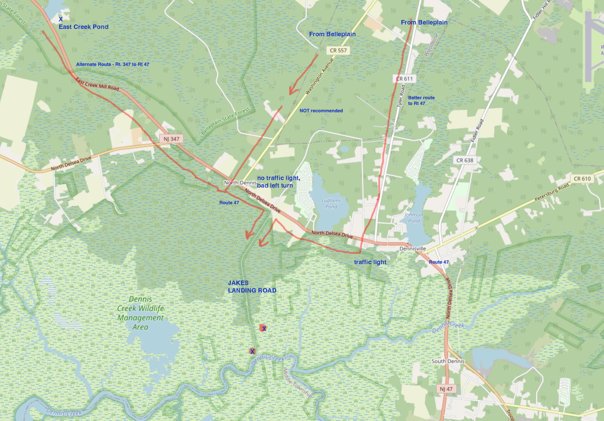
From the swamp, turn around and go back east on Sunset Rd. Here you can choose whether to (a) take Narrows Rd., (unpaved) which may have Prothonotary at the wetlands at the north end of the lake, and may have Eagles on East Creek Pond. If you do this, you will take Rt 347 (which becomes Rt 47 soon) to the right turn on Jakes Landing Rd.
Or, (b) you can return along Sunset Rd and check farmlands along Fremont and Sumner Aves,. in Woodbine; these may offer a variety of species ✪If you do this, when finished you will take Tyler Rd., not County 557, to Rt. 47 — there is a traffic light at Rt 47 and Tyler, which makes for an easier turn. Turn RIGHT on 47 then LEFT on Jakes Landing Rd.
- Birding Jakes Landing Road GPS: 39.188488, -74.853649
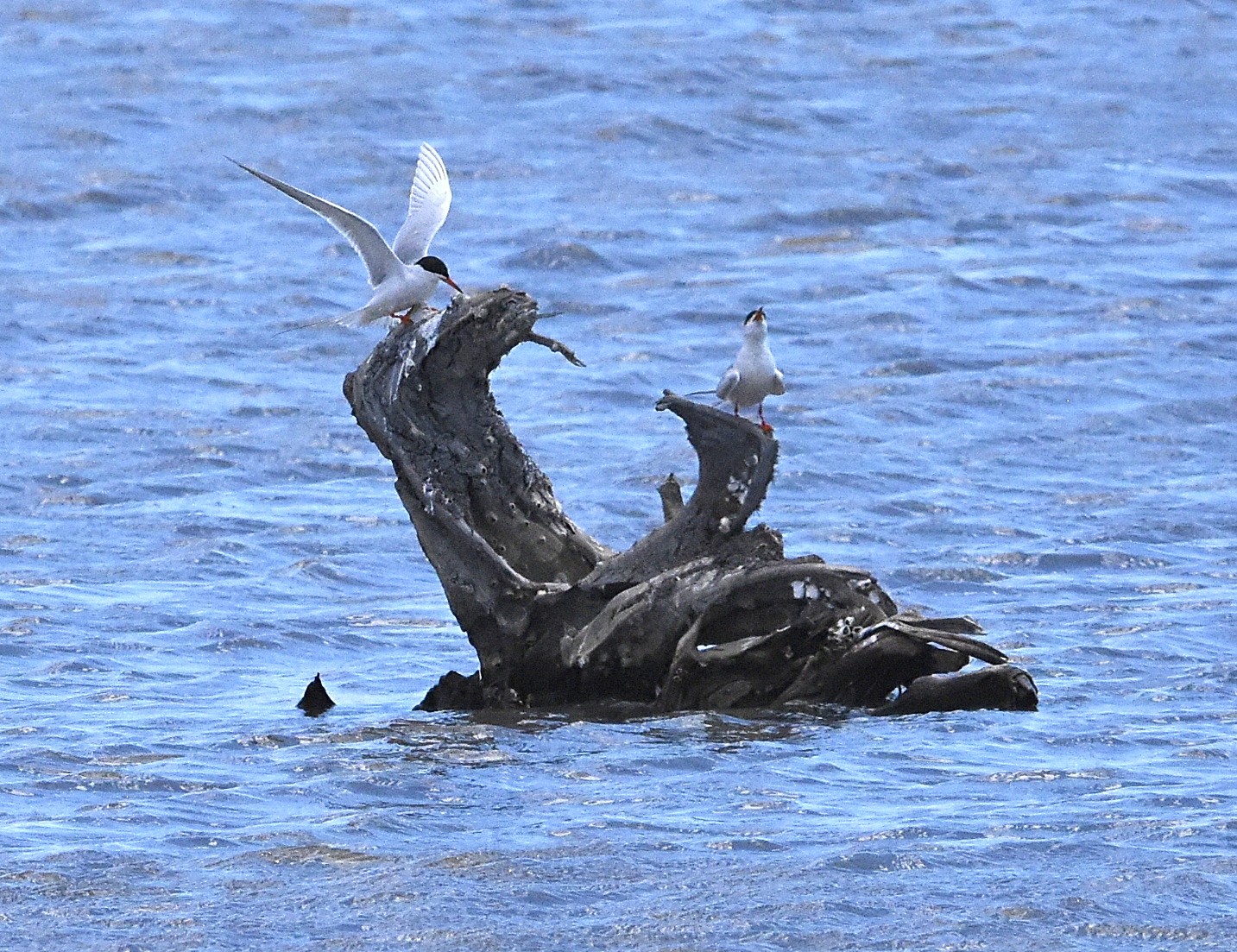
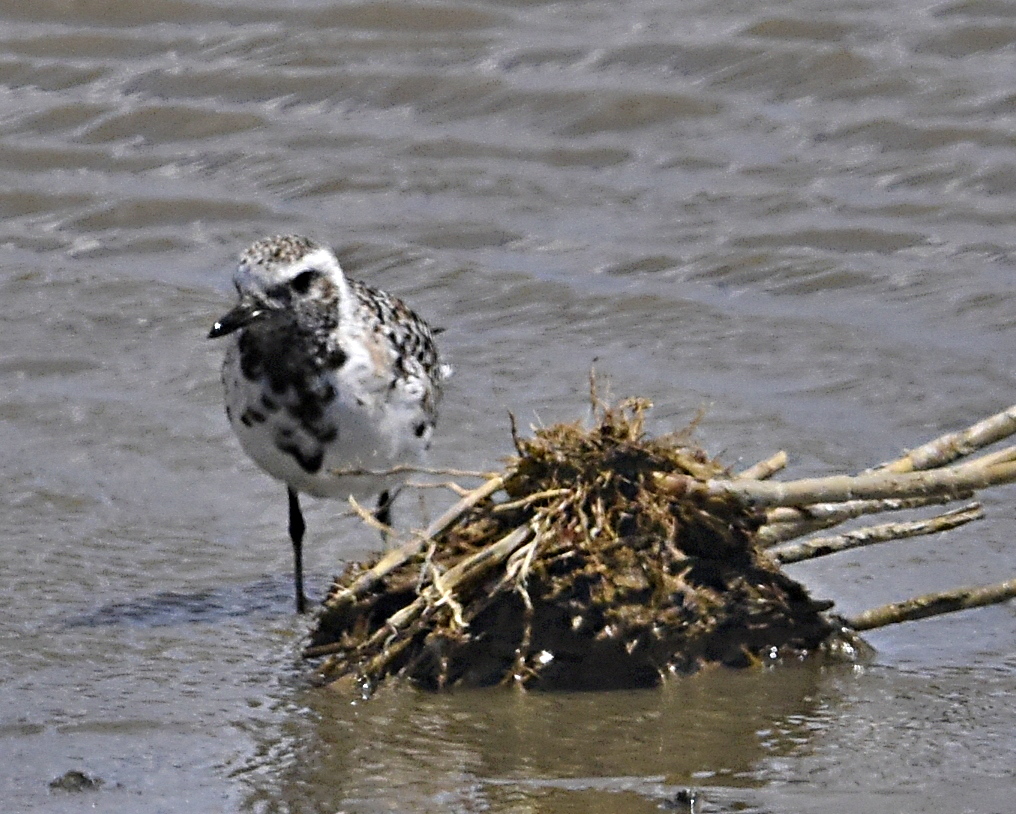
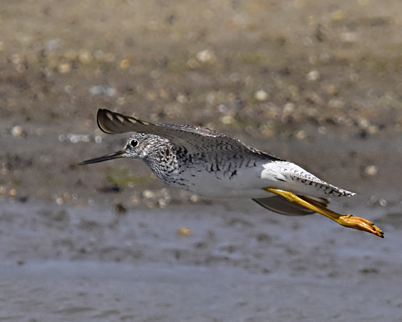
Cover the entire road, pine woods (Yellow-throated warbler) to saltmarsh (Sparrows, rails, terns, shorebirds, sparrows, wrens). Look for raptors perched on snags or over the marsh.
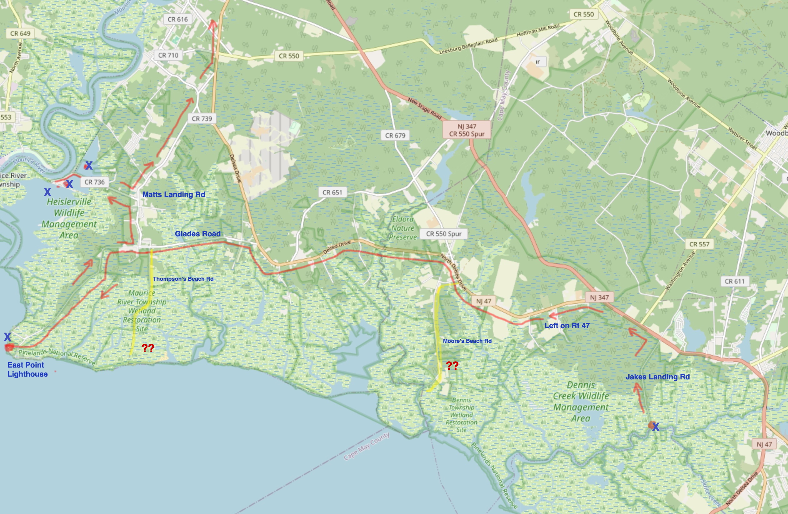
From Jakes Landing to East Point: Turn left when you return to Rt 47 and take it west. ✪Where it forks, take the left turn on old Rt 47, not the right/straight on Rt 347.
Continue to Glades Rd., 39.218102, -74.959161 Turn LEFT on Glades Rd.
If desired, you can explore Moore’s Beach Road and/or Thompson’s Beach Road. Both have been heavily affected by water level rise and salt intrusion, but used to be productive birding locations and may offer migrants. I do not know the present condition of either one.
Moore’s beach is accessed from Rt 47, and Thompson’s Beach from Glades Rd. If you do check Thompson’s Beach, return to Glades Road.
When you reach the town of Heislerville, follow signs for East Point Lighthouse.
- East Point Lighthouse: GPS: 39.194226, -75.025901
Birding: check the saltmarsh and waterfront, gulls, terns, shorebirds, swallows, Osprey. There is a chemical toilet here, at least seasonally.
From East Point to Matts Landing mudflats: Return to Heislerville the way you came, and turn LEFT, then LEFT once more, following signs for Matts Landing.
- Heislerville / Matts Landing GPS: 39.228403, -75.005315
The road ends at the Delaware Bay, at the mouth of the Maurice River. ✪On the other side of the river is Bivalve, formerly a commercial fishing/oyster port.
Birding: Check the Cormorant rookery on island. Shorebirds, herons, terns, gulls. The Delaware River flats may be productive for shorebirds if the tide is out, (climb the dike and scope from there) otherwise the shorebirds will be roosting in the impoundments.
- Return home:
From Matts Landing to Wawa: Follow River Rd north to Rt. 47 which returns to the Wawa . GPS: 39.289378, -74.968792
To reach Route 55, from the Wawa, go north on Rt 47 to Rt 55. Continue north to the Rt. 42 Freeway and 295.
To reach Rt. 206 via Hammonton, leave Rt. 55 at Exit 26, making an IMMEDIATE HARD RIGHT AFTER EXIT. Lincoln Road becomes Rt 54 and then Rt 206 north of the White Horse Pike. GPS: 39.634992, -74.804714
Click the maps above to enlarge.