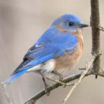
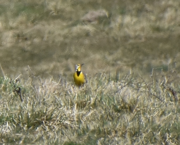
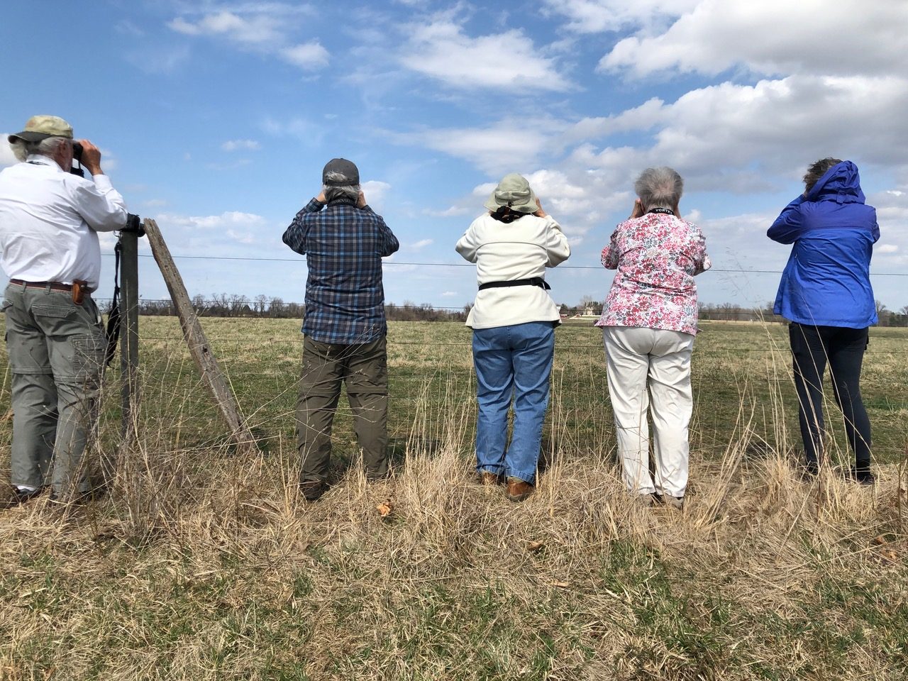
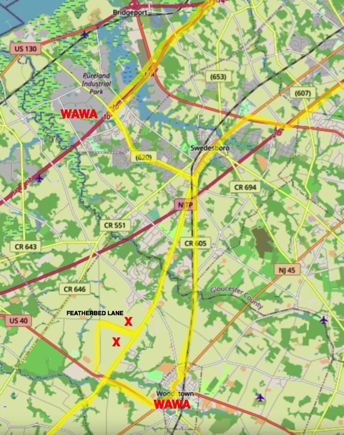
The Medford Leas Birders had a fine warm day with light clouds and a bit of wind; the showers in the forecast failed to materialize. Spring was in the air. Our stop at Featherbed lane produced one shy Meadowlark and little else, so we returned later — this time, everyone saw the Meadowlark, and three Kestrels as well.
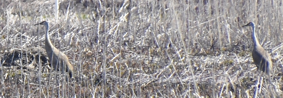
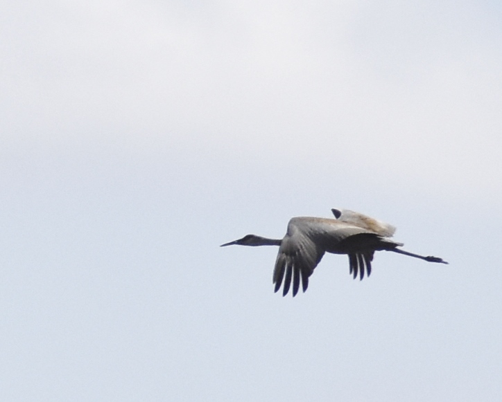
Sandhill Crane
Eastern Meadowlark
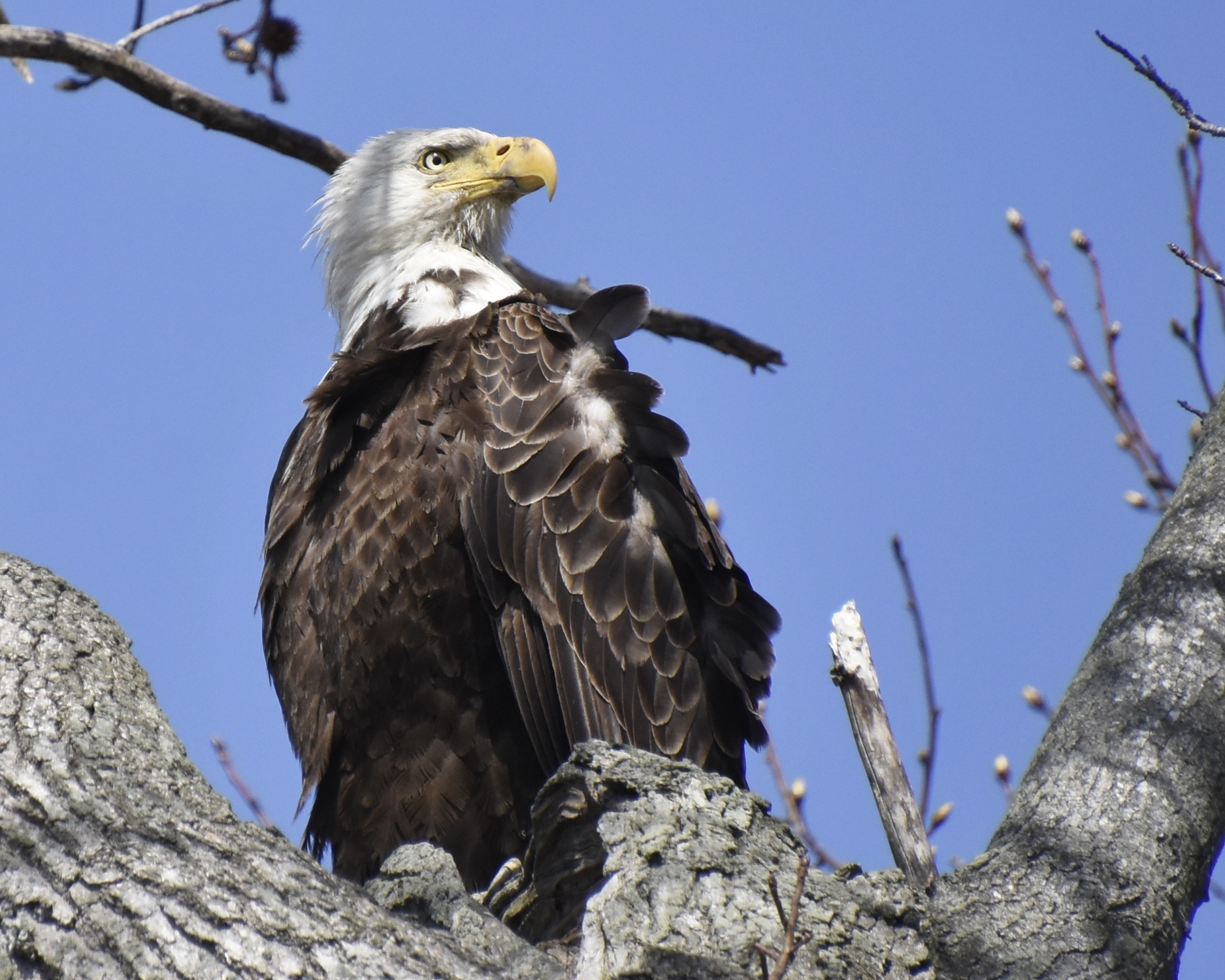
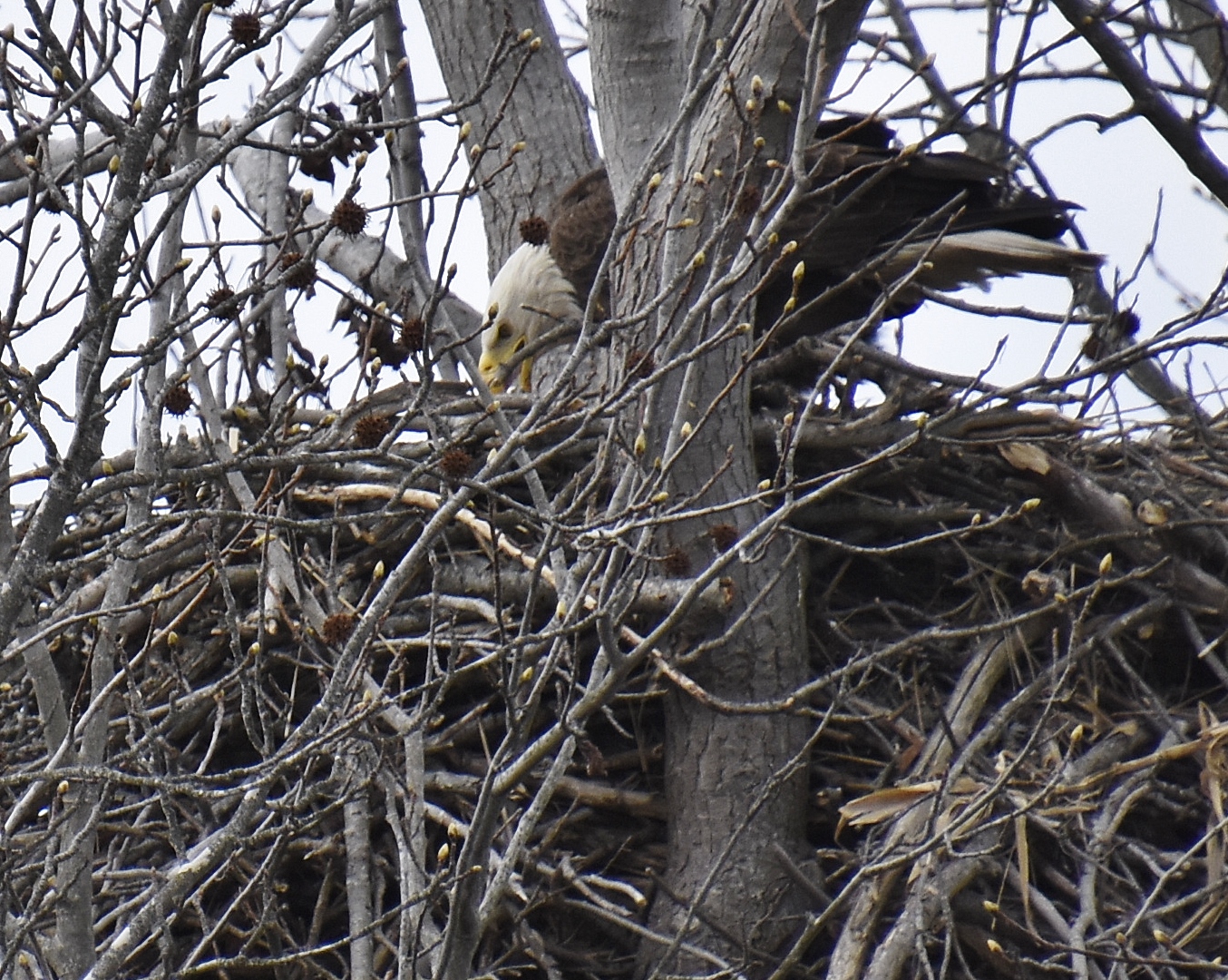
Mannington Marsh revealed few waterfowl and just a few Great Egrets at our first stops. But the Sunset Road tidal flat was very good. We immediately found three Sandhill Cranes, calling and flying across the road. Waterfowl included Green-winged and Blue-winged Teal, Shovelers and Gadwall. And we couldn’t keep a good count of Eagles, which kept moving; probably eight in all, including a pair on their nest and subadult birds in trees, on the mud flats and on fields.
Bald Eagle
Eagle Nest
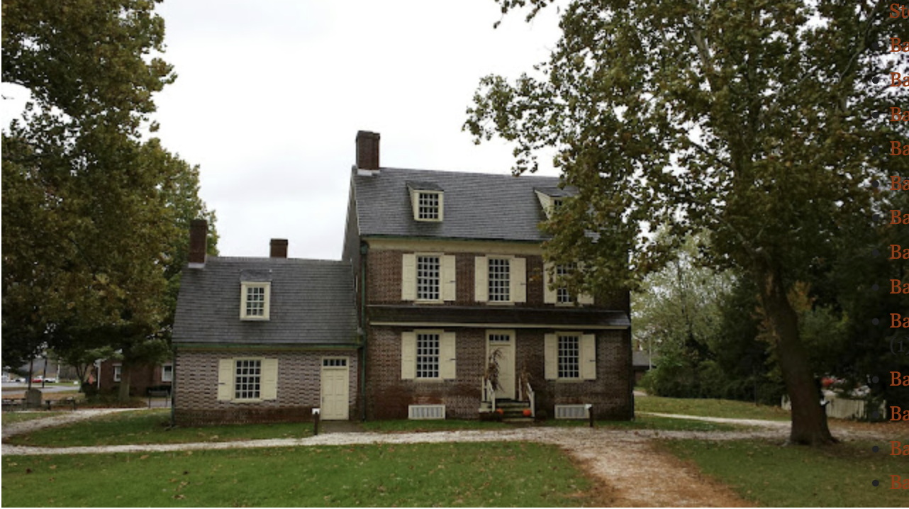
Because we saw so many eagles here we skipped the landfill and headed down to Hancock’s Bridge on the Alloways Creek. We stopped at the Hancock House historical site, which was actually open, and celebrating the 245th (or so) anniversary of the Massacre, March 19, 1778. Interpreters in Revolutionary militia uniforms told us the site’s story. An account is at https://www.thehistorygirl.com/2013/02/the-massacre-at-hancocks-bridge.html
Hancock House
Alloways Creek
After lunch, we proceeded to Mad Horse Creek WMA, east of Canton along the bay shore. The roads here wind among the salt marshes, hedgerows, woods and fields. We found a heronry with many Great Blue Herons on their nests; many Green-winged Teal; and a roost of 30 Greater Yellowlegs, the first shorebirds of the season. Raptor migration was evident, and we saw half a dozen Kestrels, many vultures, a Cooper’s Hawk, a few Harriers, and even more Eagles, with two more nests. As a spectacular finale, a Barred Owl flew in front of our cars at the Mad Horse boat launch after being flushed by a fisherman. A great day!
Participants: Lee and Nicky Harp, Robert Koch, Dino Fiabane, Laurie Larson, Judy Norcross, Miriam Swartz, Kathy Tarr, Barbara Trought, Mary Walter.
Photos by Robert Koch; text by Laurie Larson
Robert, Dino, Miriam, Barbara, Kathy
Bird List: 51 Species
Snow Goose Canada Goose Mute Swan Wood Duck Blue-winged Teal Northern Shoveler Gadwall Mallard American Black Duck Green-winged Teal Ring-necked Duck Rock Pigeon Mourning Dove Sandhill Crane Greater Yellowlegs Ring-billed Gull Herring Gull Great Blue Heron Great Egret Little Blue Heron Black Vulture Turkey Vulture Northern Harrier Cooper’s Hawk Bald Eagle Red-tailed Hawk Barred Owl Downy Woodpecker American Kestrel Blue Jay American Crow Fish Crow Tree Swallow Purple Martin Tufted Titmouse Winter Wren Carolina Wren Eastern Bluebird American Robin Northern Mockingbird European Starling House Sparrow House Finch Dark-eyed Junco White-throated Sparrow Song Sparrow Eastern Meadowlark Red-winged Blackbird Brown-headed Cowbird Common Grackle Northern Cardinal
MEDFORD LEAS BIRDERS SALEM COUNTY
This route is traditional in early spring but also may be visited in winter (raptors and field birds) or late summer (butterflies, botany, marsh birds).
3/19/22 forecast was for “Showers likely, with thunderstorms also possible after 2pm. Mostly cloudy, with a high near 74. South wind 10 to 15 mph. Chance of precipitation 70%. New rainfall amounts between a quarter and half of an inch possible. ” Fortunately, the weatherman was wrong, and we enjoyed a mostly clear day with light breeze.
Tide at Salem (south end of Mannington Marsh) was high at midday.
Directions:
TO WOODSTOWN:
Take NJ Turnpike south to Exit 2 (Rt. 322). From exit, turn left (West) on 322 and go to first intersection. Turn left (south) on 551, Kings Highway. In Swedesboro, the road will fork; stay on Rt. 551 to Featherbed Lane.
Swedesboro to Woodstown
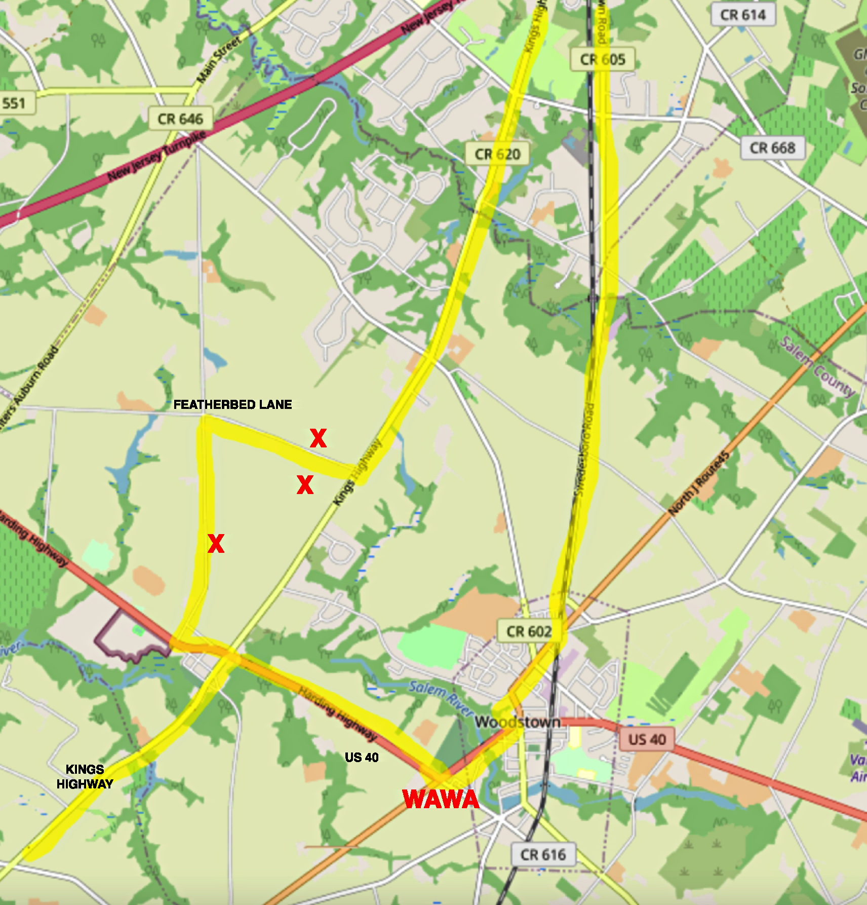
FEATHERBED LANE:
The usual viewing is from the 2 red “Xs” but I have heard this may be posted now. If so, there is a pull out on Kings Highway OR try the quiet road that is parallel to Kings Highway and has a view of the same rolling fields. Look for Meadowlark, grassland sparrows, raptors, or (in winter) Snow Geese.
Featherbed Lane, Sharptown
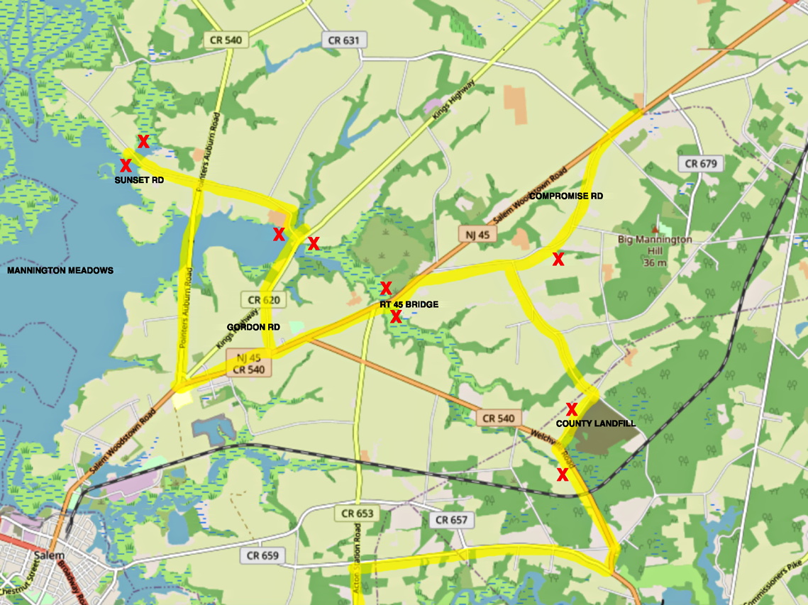
WOODSTOWN TO MANNINGTON:
From Wawa, take Rt. 45 south. If desired, check Compromise Rd. (left fork at the memorial Fenwicke rock, then return to Rt. 45). Stop at the Rt 45 bridge and scan both ways for waterfowl and Sandhill Cranes. There are two obs. towers but both are overgrown with phragmites; view from the road. Traffic here is awful.
Continue south on Rt 45 to Gordon Road, right turn. Cross the marsh on the causeway. Stop just past the bridge, park on right, scan both ways. This can be good for waterfowl, snipe, herons, depending on tide.
Turn left from the Causeway on Seabrook Rd. Drive slowly and scan fields for pipits (in winter). Cross Rt. 540 (Seabrook becomes Sunset Rd. here.)
Proceed to the fishing overlook at tidal access and check for eagles, Sandhill cranes, waterfowl, early shorebirds, snipe, swallows.
If desired make the loop (straight ahead) through Marshalltown then turn right on Rt 540. Otherwise, turn around on Sunset and return directly to 540 and turn right.
Cross the Rt 540 causeway slowly, watching for eagles, waterfowl, etc. The traffic here can be dangerous so it is not a good idea to stop on the causeway. It is possible to turn left into a small parking area just past the causeway and scan from there.
Mannington Area
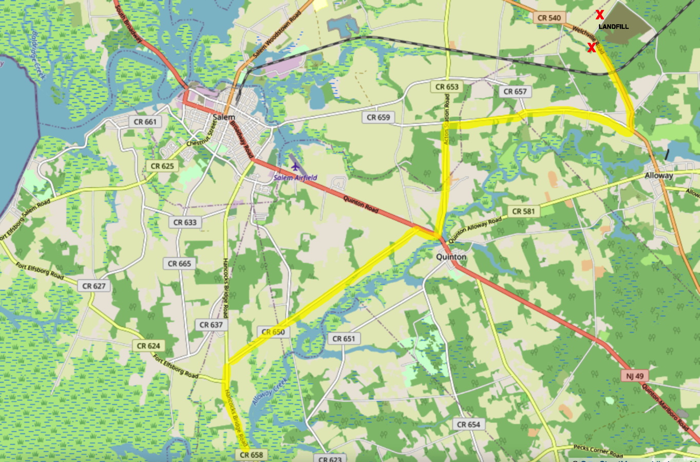
LANDFILL TO HANCOCKS BRIDGE:
The county landfill can attract Eagles and Gulls in winter. To reach it, from Mannington take 45 north to Compromise Road. Turn Right on Swedes Bridge Rd., turning right again at the crossroad. Take the first left on Welchville Rd. There are pull-offs at several places but be careful of traffic.
To reach Hancock’s Bridge, turn right on Quaker Neck Rd. Continue on Quaker Neck to fork, bear left on Clancy Rd. (CR 659) to crossroad Turn left (south) on CR 653, Acton Station Rd. Turn right on Rt 49 – don’t cross Alloways Creek, but turn left again almost immediately on CR650, Quinton/Hancock’s Bridge Rd. Follow the creek past crossroad (new bridge Rd) to Hancocks Bridge Rd. CR 658.
Hancocks Bridge
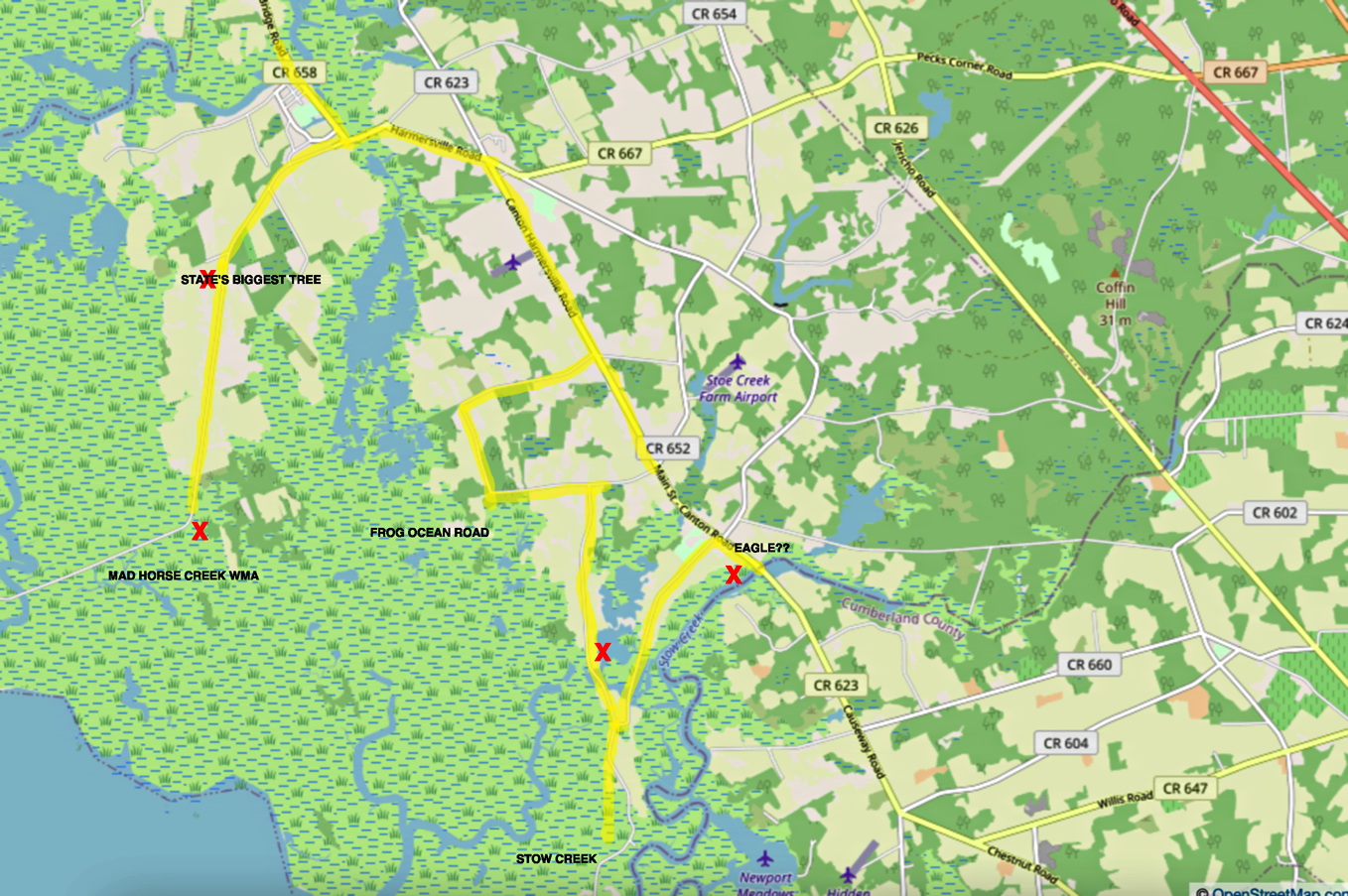
HANCOCKS BRIDGE, MAD HORSE CREEK, FROG OCEAN ROAD:
Stop in Hancock’s bridge and visit the Revolutionary War historical site. Return to Hancock’s Bridge Rd. At the light, turn left; go to another light and turn right on Harmersville/Canton Rd.
To reach Mad Horse Creek WMA: Turn right (south) on Silver Lake Rd., which becomes Fogg Rd., which becomes Frog Ocean Rd. Stop wherever you see birds.
At the Mad Horse Creek road turn right and follow it to the dead end at a boat launch. Raptors, waterfowl, shorebirds are possible depending on season. There is a Great Blue Heron rookery visible before leaf out.
Retrace your route from the boat launch. Turn right again on Harmersville/Canton Rd. and stop at the Stow Creek State Park viewing platform for interpretive signage. Look for raptors, early shorebirds and ducks. If you cross the creek here, you will be in Cumberland County.